
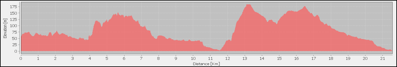
General Information
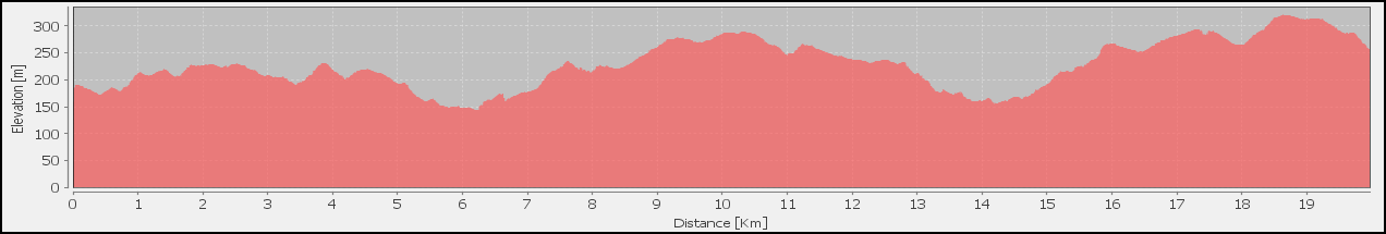
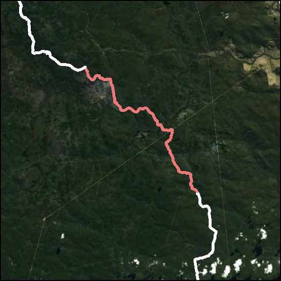
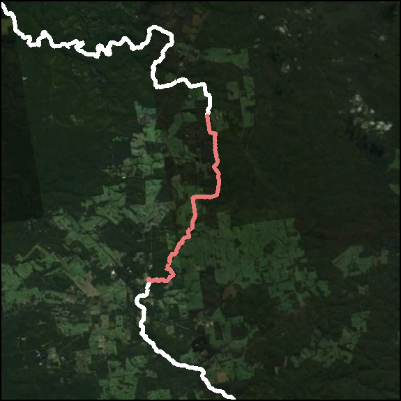
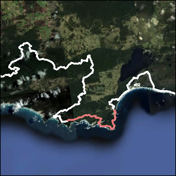
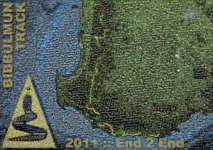
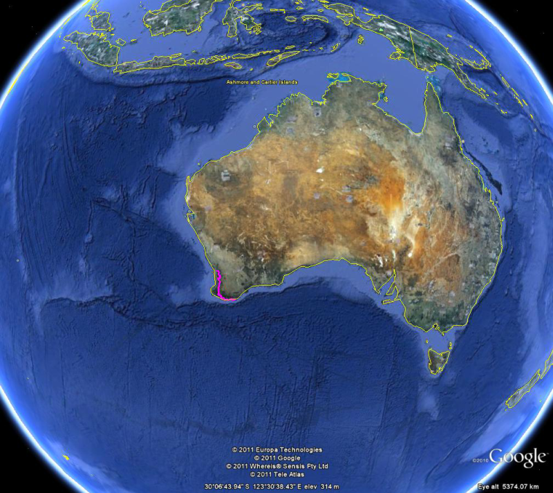 The Bibbulmun Track is one of the world's, and definitely one of Australia's, great long distance walk trails, stretching nearly 1000kms from Kalamunda (Perth Hills) to Albany (South Coast) through the heart of the scenic South West of Western Australia. The track opened in 1979 and consists of 50 sections that are approximately one days walk, with a purpose built camping area (shelter, water tank, pit toilet and tent sites) at the end of each day.
![]() Bibbulmun Track: 1021km over 54 days
Bibbulmun Track: 1021km over 54 days
It's taken 10 weeks after finishing the Bibbulmun Track to start to feel normal and productive enough to get some of our photos and reflections in order. The sheer enormity of the undertaking and effect of the experience has taken me by surprise: but we've managed to navigate those dangerous waters without doing anything totally crazy, and are now getting some of the product of the walk published. The numbers still boggle my brain:
| 1 | journey |
| 2 | people |
| 12 | camp grounds |
| 35 | kg of food eaten |
| 53 | over-nights |
| 143 | SPOT2 Messages |
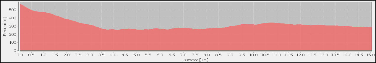
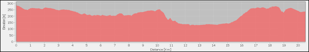
| 316 | hours of walking |
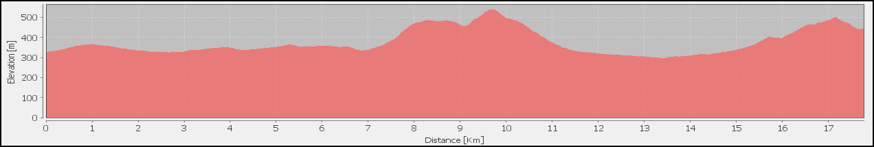
| 1,021 | kilometres of track |
| 5,223 | total $cost |
| 9,106 | photographs taken |
| 44,416 | words written |
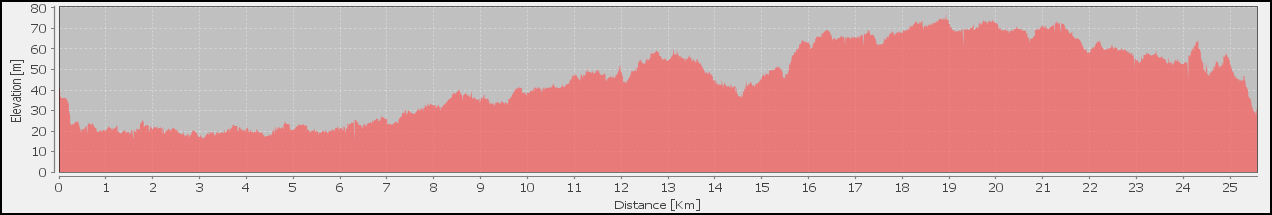
| 49,036 | metres skipped down |
| 49,407 | metres trudged up |
| 90,919 | GPS points recorded |
| 1,215,573 | footsteps |
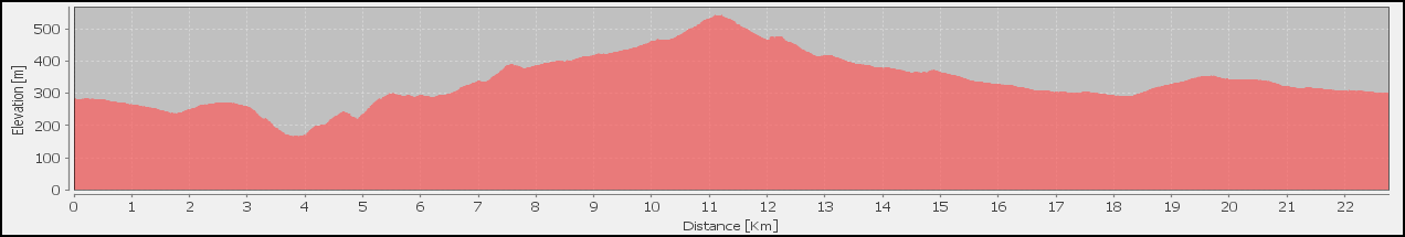
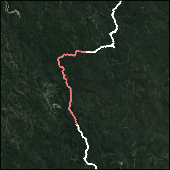
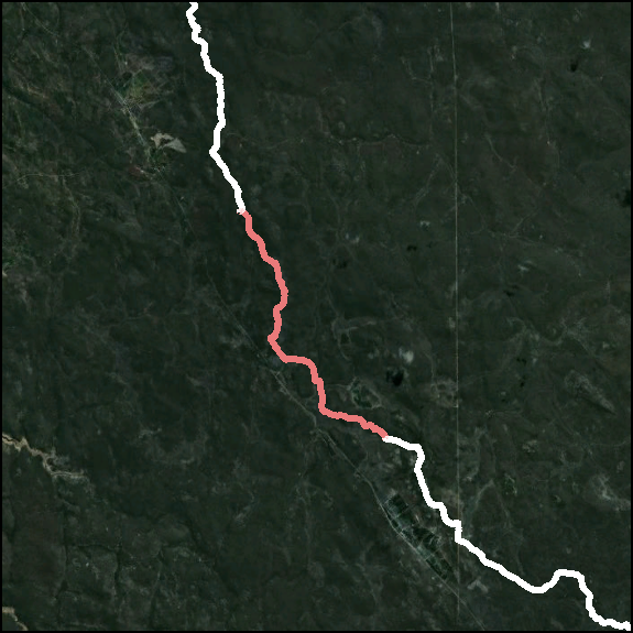
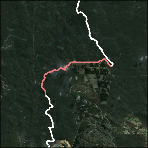
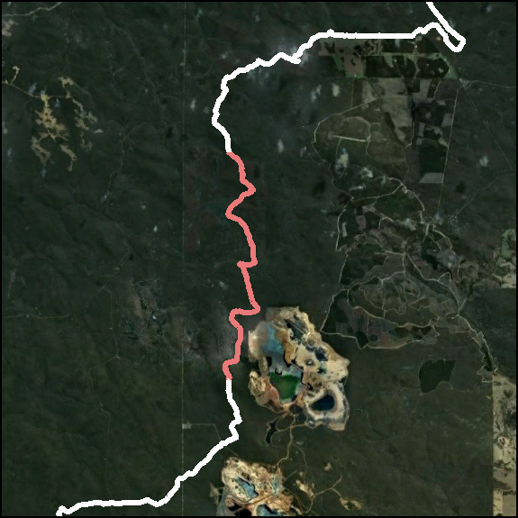
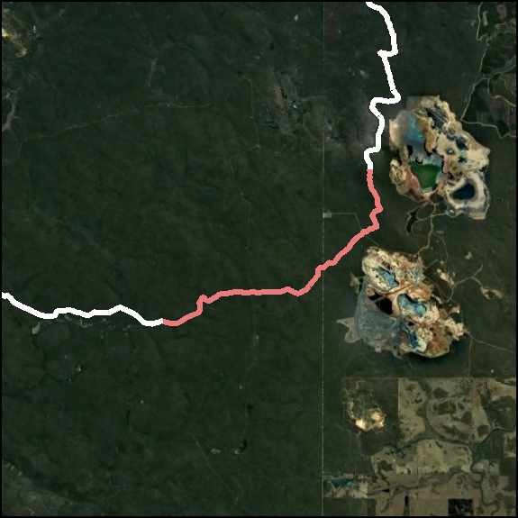
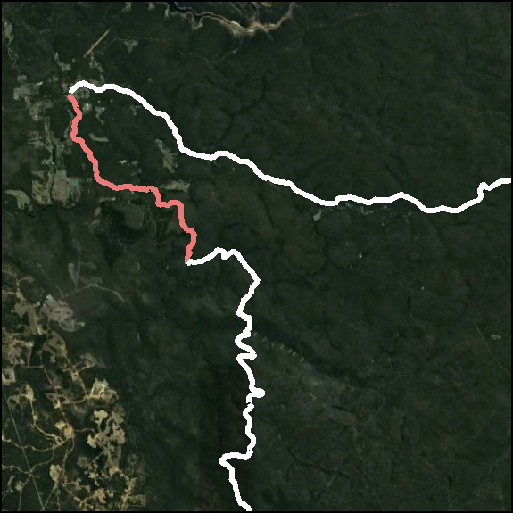
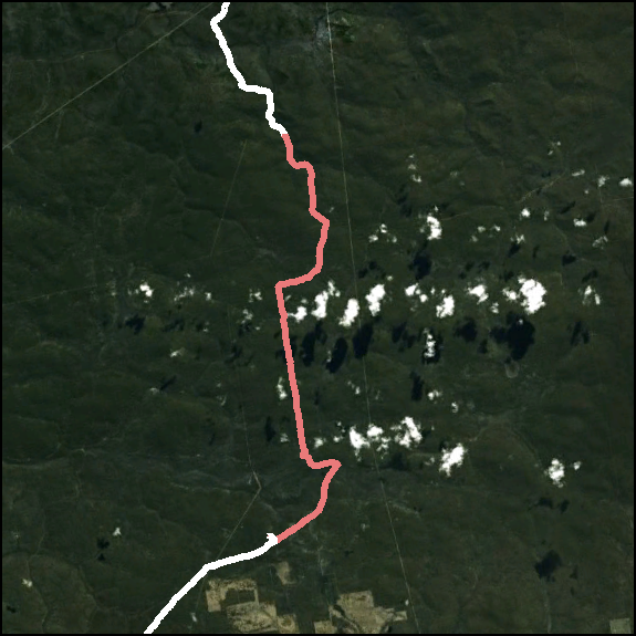
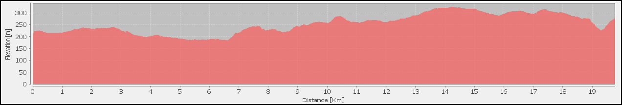
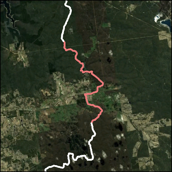
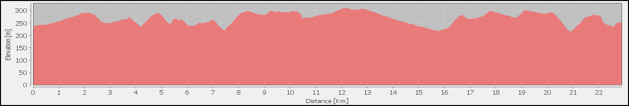
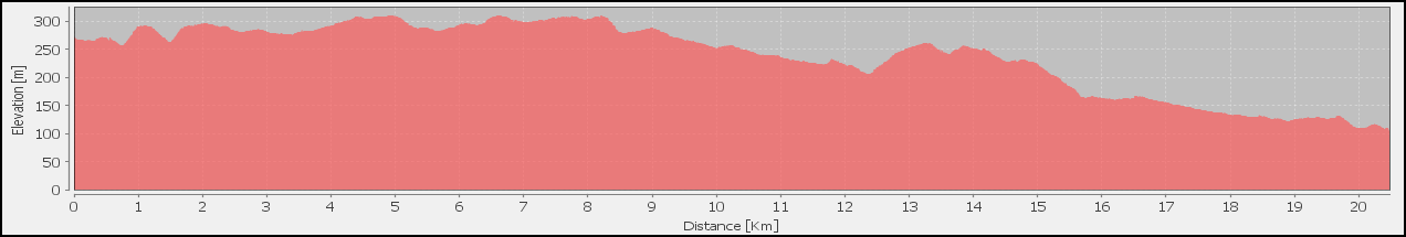
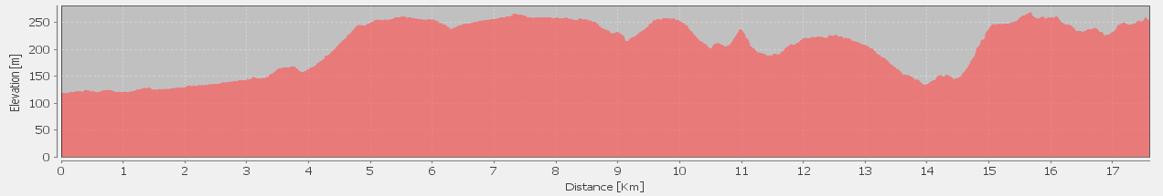
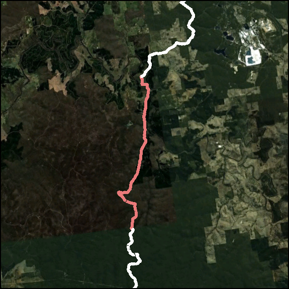
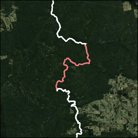
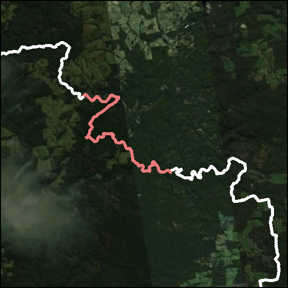
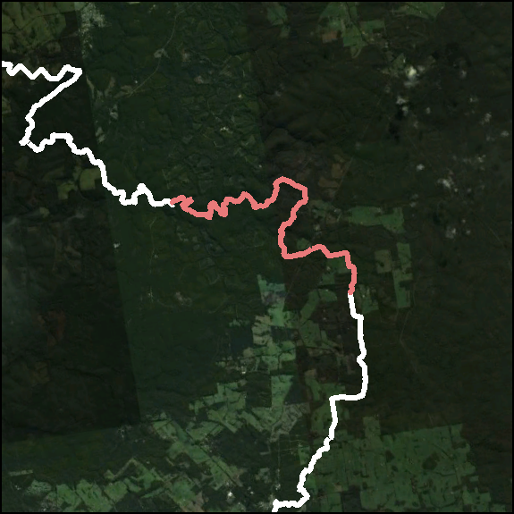
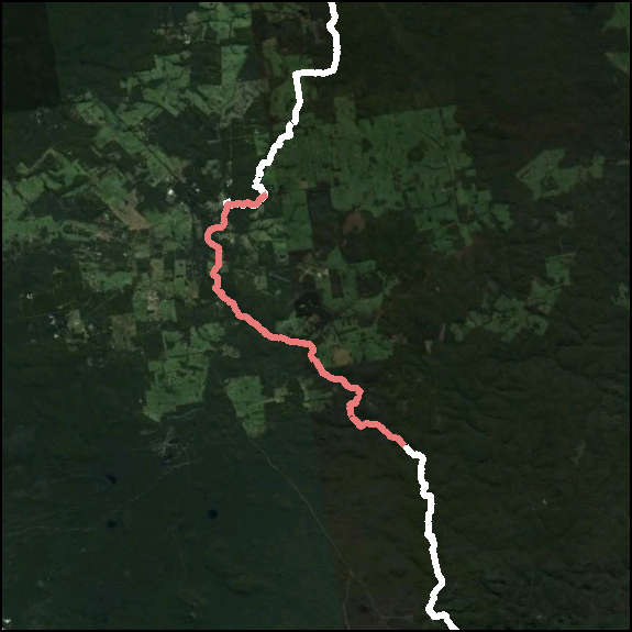
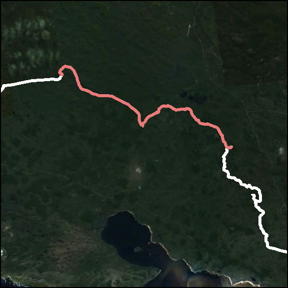
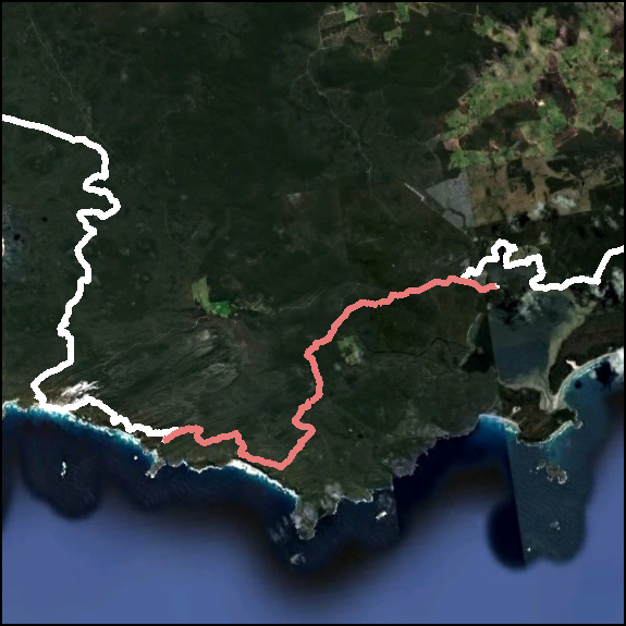
Our GPS tracks can be downloaded at right as either Day Tracks (53 covering the complete 2 month trek) or Section Tracks (the Foundation's 58 sections as detailed in their Guide and Maps). Alternatively, the complete track comprising the 53 Days, or the Northern Sections and Southern Sections.
Note: these tracks should not be loaded directly into a GPS unit as they are very raw and should be simplified. I'd recommend saving individual Points of Interest out and using those, rather than a whole track.
Timelapse
 Over the 54 days of our trek, we took a portrait photo each morning before setting off on the day's walk and then each afternoon when we'd reached camp – often capturing the morning's optimism and then the afternoon's pain of the journey on our faces.
Thanks to Tetra for making Walking available  : Walking 5 fitted very well with this project.
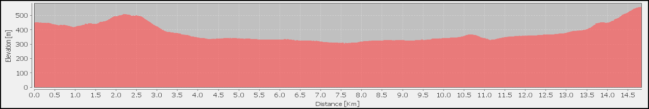
InfoGraphics
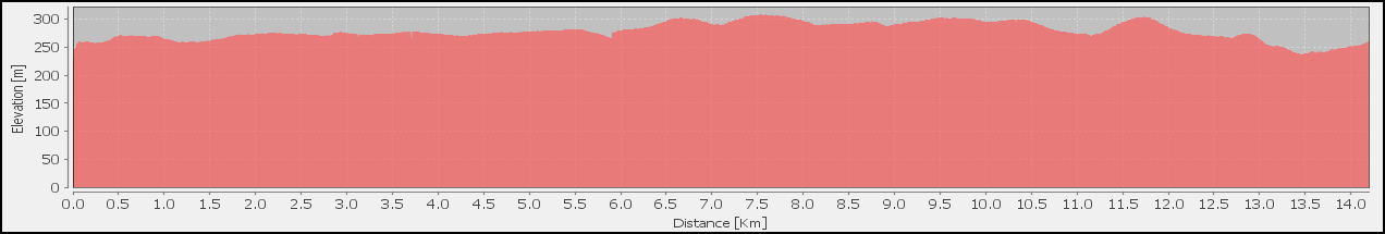
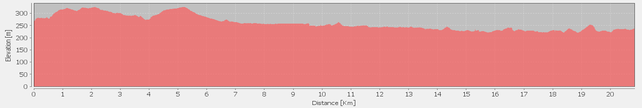
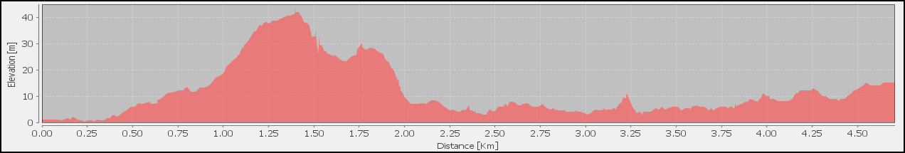
Over the period of the walk we compiled quite a lot of data that I've been using for my equipment reviews, which have produced some interesting graphics:
Blog Posts
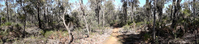
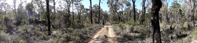
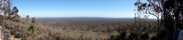
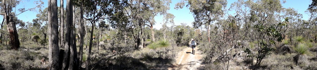
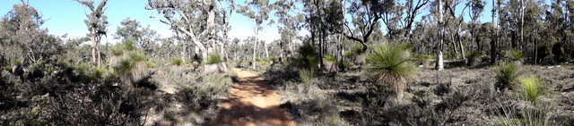
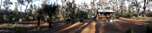
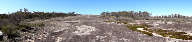
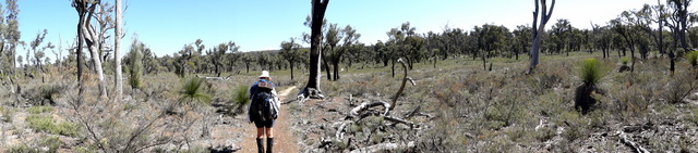
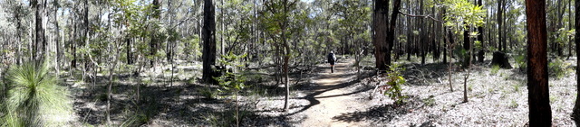
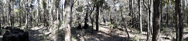
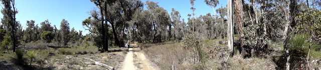
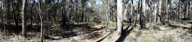
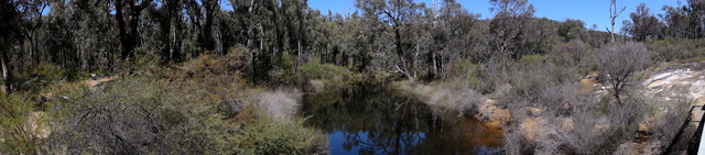
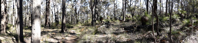
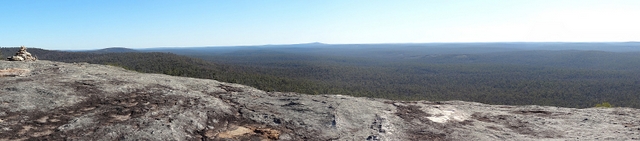
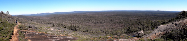
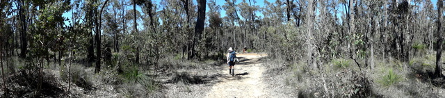
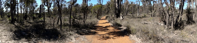
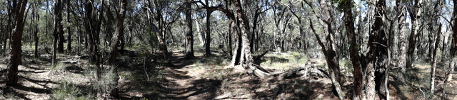
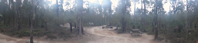
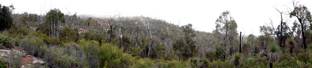
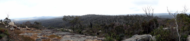
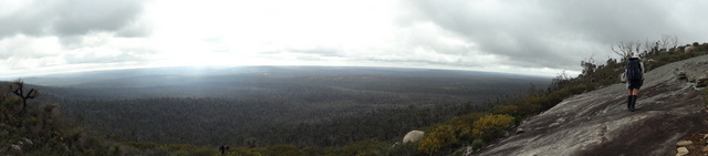
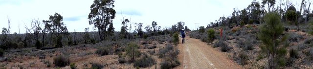
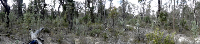
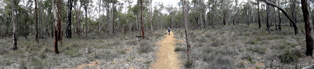
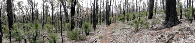
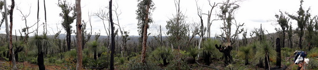
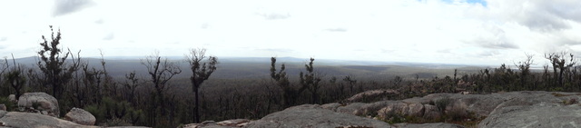
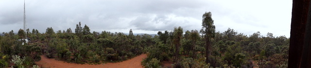
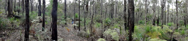
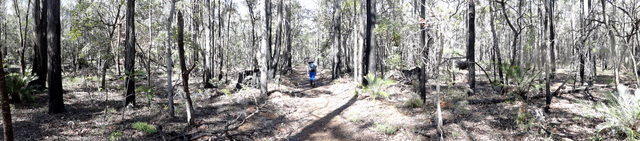
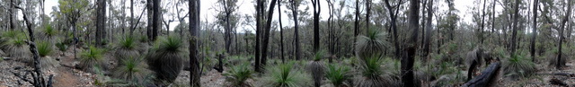
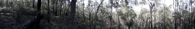
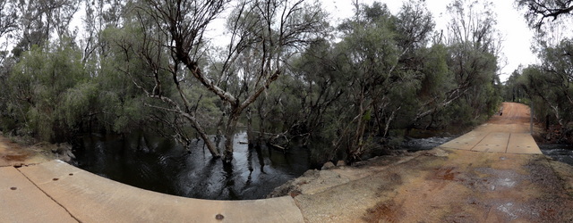
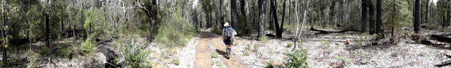
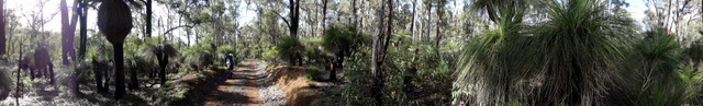
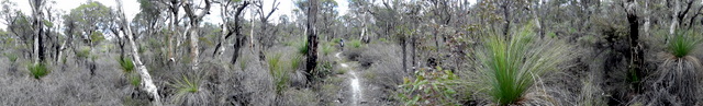
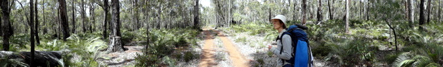
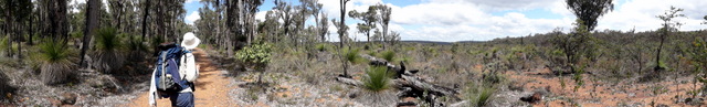
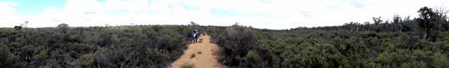
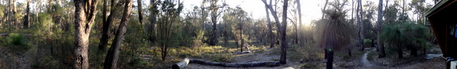
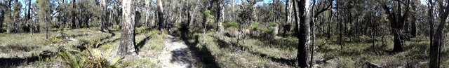
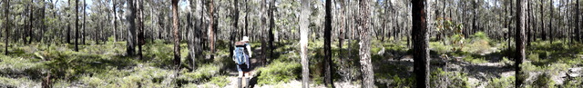
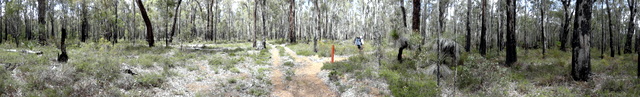
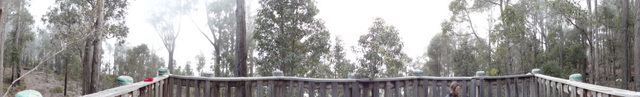
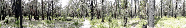
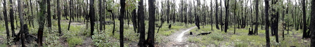
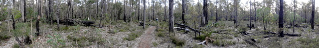
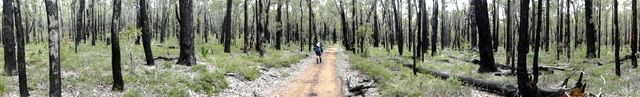
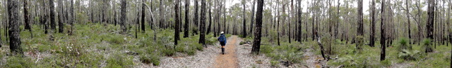
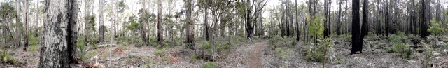
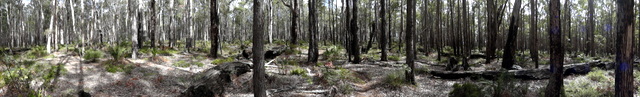
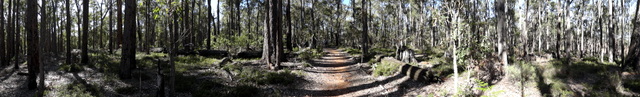
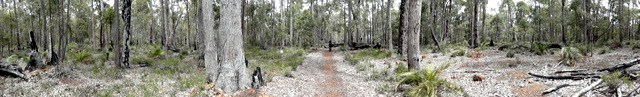
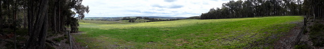
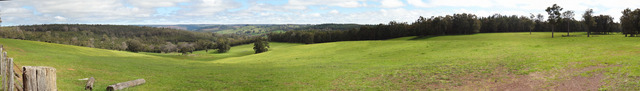
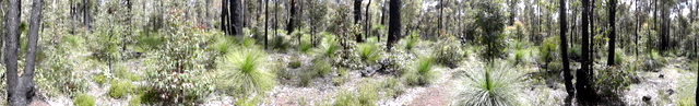
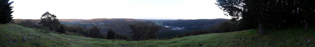
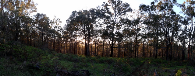
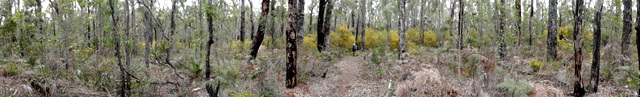
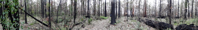
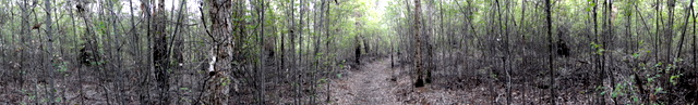
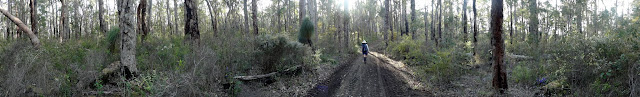
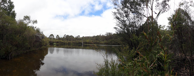
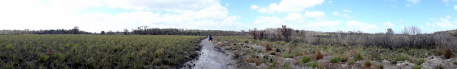
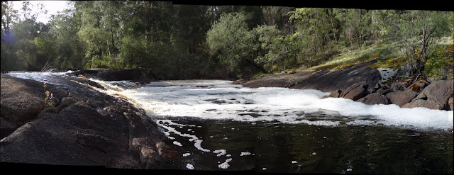
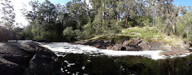
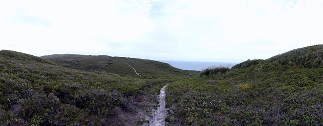
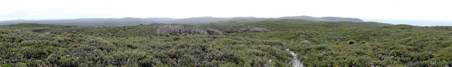
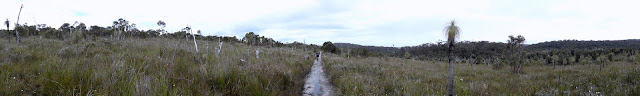
Our blog posts are grouped into the 8 weeks of the walk and illustrated with the Panoramas we took from each day. The actual blog posts are stuffed full with photos, and the galleries are available in the right panel.
Week One: Kalamunda to Mt Cooke
After a rigorous 6 months of planning, training and buying we were actually on the ground and in the final count down: it's probably good that we were so busy, because otherwise we'd probably be scared out of our wits :)
We gave ourselves three days to organise our food-drops and deliver them, which in the end was only just enough and probably a little under-estimated as our diary entries indicate.
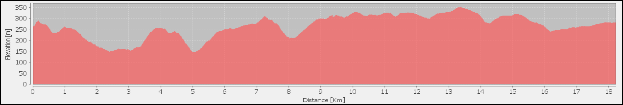
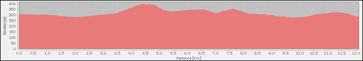
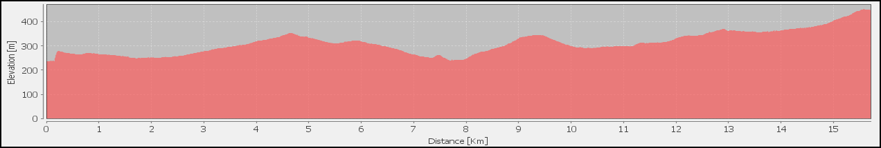
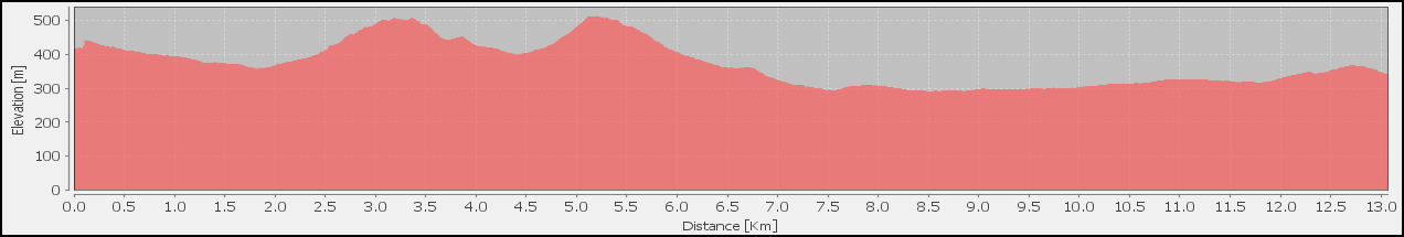
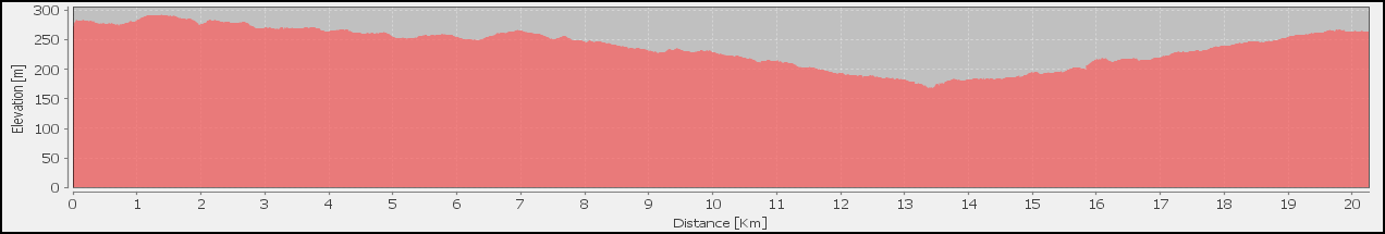
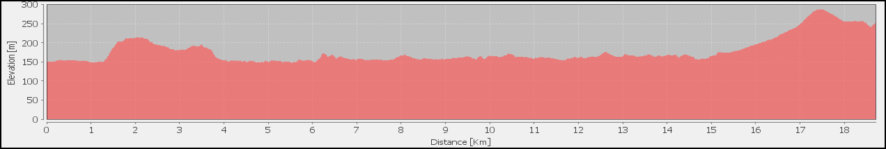
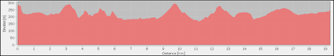
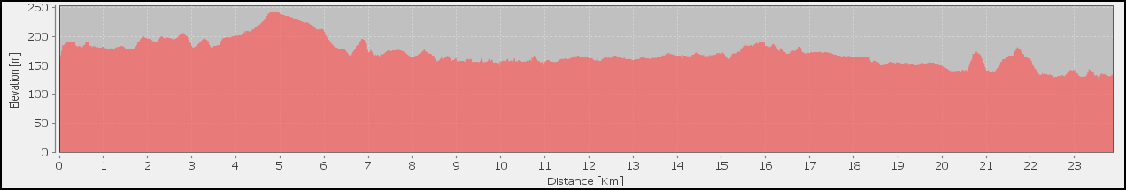
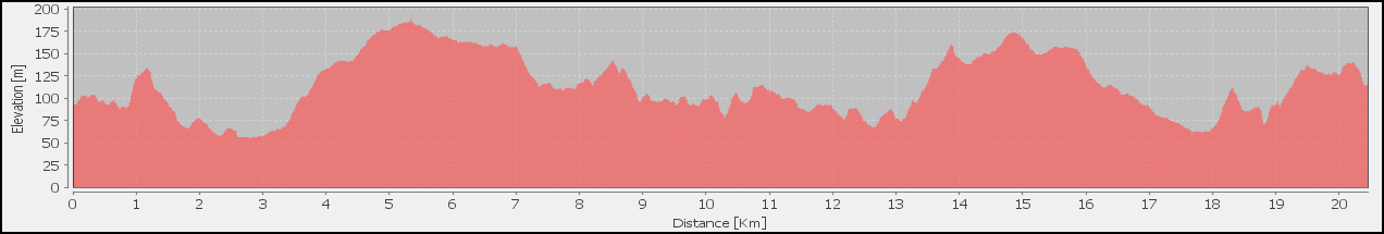
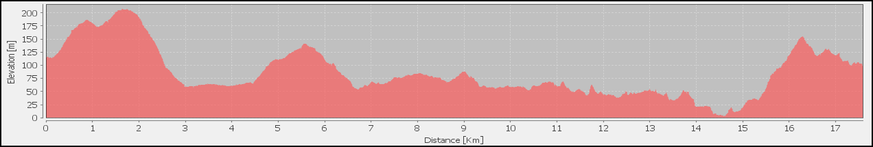
| Length | 10.84 km | Day Length | 3:22 |
| Ascend | 465 m | Descend | 550 m |
| Walk | 2:34 | Average | 4.2 km/h |
| Breaks | 0:00 | Average | 3.3 km/h |
| Stop | 0:48 | Average | 3.2 km/h |

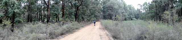
After public transport to Kalamunda and morning tea we finally hit the track and head off on our journey, our aim on Day 1 is Hewitt's Hill. Today's walk, essentially just to get us actually onto the track, takes us from the bush amongst the suburbs and semi-rural areas of Kalamanda toward the East and Hewitt's Hill.

| Length | 20.43 km | Day Length | 7:18 |
| Ascend | 1187 m | Descend | 1047 m |
| Walk | 4:46 | Average | 4.3 km/h |
| Breaks | 1:37 | Average | 3.6 km/h |
| Stop | 2:32 | Average | 2.8 km/h |
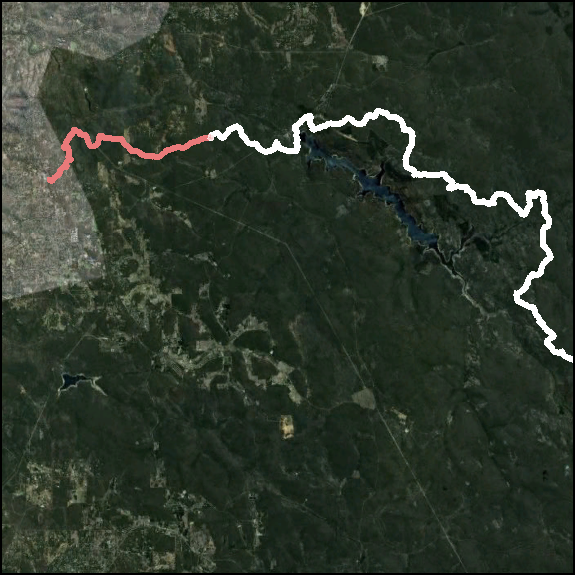
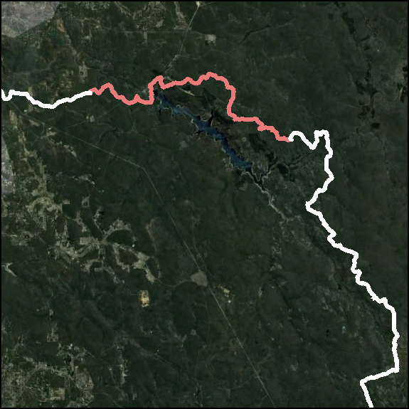
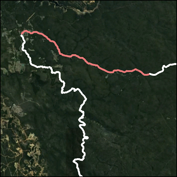
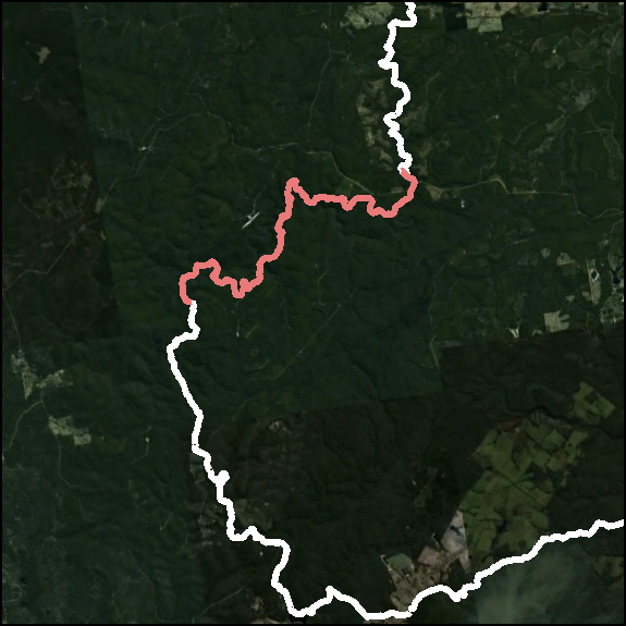
Day 2 covers 2 Sections from the Guidebook, initially on the well used tracks around Kalamunda and Mundaring Weir, it takes you past some impressive views on it's way to Mundaring Weir where we plan to partake of the Hotel's fine hospitality for morning tea.

Ball Creek campsite is at the end of the first section, after a climb out of Mundaring Weir on more well used tracks, and is where we have lunch.
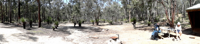
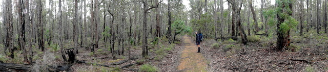
The second section finally starts to feel like we're leaving civilisation behind, and takes us from the Jarrah / Marri forests around Ball Creek into some Wandoo woodlands around the creeks before climbing out of Mann's Gully through increasingly exposed granite and boulders and eventually reaching the gloriously exposed Helena campsite and its wonderful view.


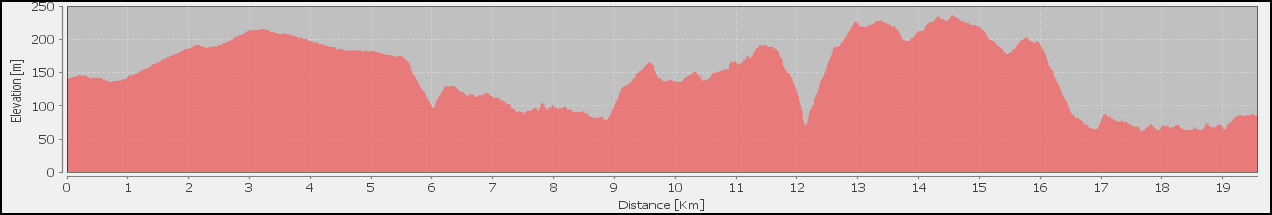
| Length | 18.68 km | Day Length | 7:53 |
| Ascend | 1242 m | Descend | 1117 m |
| Walk | 4:36 | Average | 4.1 km/h |
| Breaks | 1:21 | Average | 2.9 km/h |
| Stop | 3:17 | Average | 2.4 km/h |
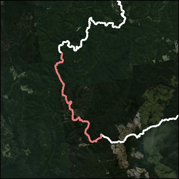
Day 3 is again covering 2 Sections from the Guidebook. Walking from Helena campsite along the old Driver Road the track winds down to cross Helena River then passes through some more wonderful Wandoo forests (that we fell in love with), a wonderful morning tea stop, and finishes at Waalegh campsite for lunch.
The second section today is more level along the rim of the Darkin River valley, with some wonderful views along the way, and ends up at Beraking campsite, which has a lovely outlook over the Darkin River valley.

| Length | 22.4 km | Day Length | 7:13 |
| Ascend | 1180 m | Descend | 1058 m |
| Walk | 5:02 | Average | 4.5 km/h |
| Breaks | 1:45 | Average | 3.8 km/h |
| Stop | 2:11 | Average | 3.1 km/h |
Day 4 is yet another "double-hutter" where we cover 2 Sections from the Guidebook. The track continues on Ruen Road before descending to the Darkin River and then climbing up into the Dale Conservation Park, which had some incredibly stunning; the optional walk up to the lookout on Mt Dale, and finally finishing at Mt Dale campsite for lunch.

The second section from Mt Dale campsite passes through much flatter terrain, generally on old vehicle tracks. After turning off Plunket Road the track passes through open country with some naturally treeless areas, shallow watercourses and finishes up at Brookton campsite set amongst open Wandoo woods.

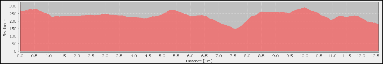
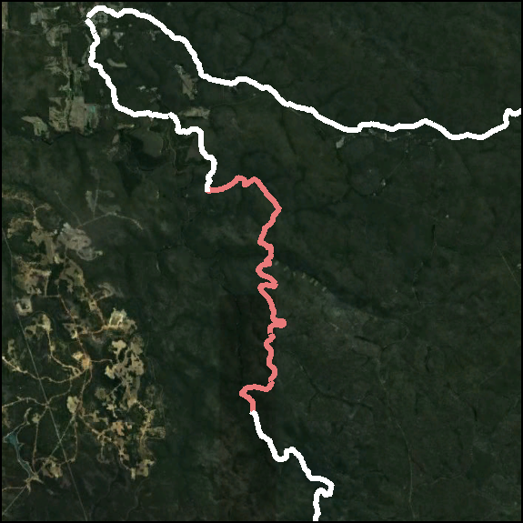
| Length | 12.47 km | Day Length | 4:35 |
| Ascend | 515 m | Descend | 439 m |
| Walk | 3:01 | Average | 4.1 km/h |
| Breaks | 0:00 | Average | 2.8 km/h |
| Stop | 1:34 | Average | 2.7 km/h |
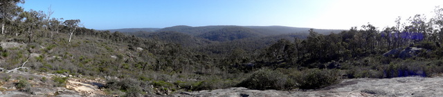
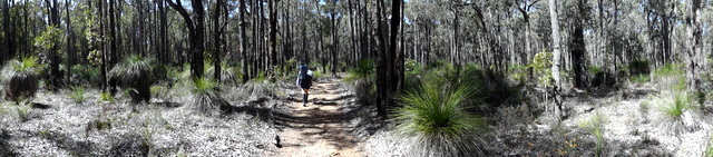
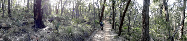
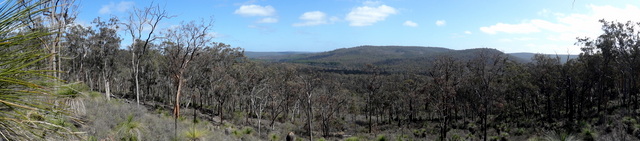
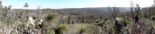
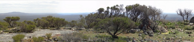
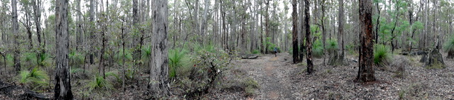
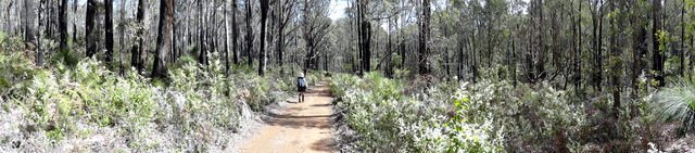
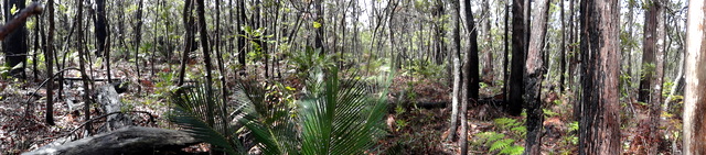
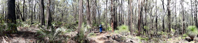
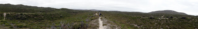
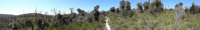
Day 5 is a much easier walk with exceptional optional extras: Starting in Brookton's open Wandoo woods, the track winds through Jarrah / Marri forests, crossing the Brookton Highway in the midst, and passing through a whisper quiet Sheoak grove then onto Abyssinia Rock: we follow the Guidebook's advice and take time on top of the rock, which was a significant time in our walk.

Abyssinia Rock is highly recommended and abounded with flowers and wonderful 360° long views. After Abyssinia Rock the track heads West through swampy flats and Jarrah / Marri / Sheoak forest before arriving at the Canning campsite.

| Length | 16.15 km | Day Length | 6:18 |
| Ascend | 600 m | Descend | 500 m |
| Walk | 3:45 | Average | 4.3 km/h |
| Breaks | 1:10 | Average | 3.3 km/h |
| Stop | 2:33 | Average | 2.6 km/h |
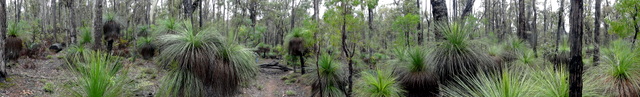
Day 6 starts in a dense Jarrah forest before descending to a broad swampy watercourse and climbing into Monadnocks Conservation Park and an area of Virgin (unlogged) Jarrah forest before descending to the Canning River.
The Canning River was a surprise with a very pretty, swimmable billabong that provided a wonderful stop before the climb up to Monadnocks campsite through a remarkable landscape of grass trees and granite.
| Length | 13.42 km | Day Length | 6:08 |
| Ascend | 871 m | Descend | 947 m |
| Walk | 3:43 | Average | 3.6 km/h |
| Breaks | 0:44 | Average | 2.5 km/h |
| Stop | 2:25 | Average | 2.2 km/h |
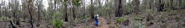
The Guidebook promised that Day 7 would be more challenging and spectacular: and it certainly was absolutely spectacular and a delightful wander through a natural flowering rock garden. The track initially winds through another whisper quiet Sheoak wood as it climbs up to Mt Cuthbert, across the saddle, then up Mt Vincent.
The track down Mt Vincent bypasses Sullivan Rock and crosses a broad creek system on an old railway formation (Cooke Road) before heading East to Mt Cooke campsite through some stands of Sheoak, Banksia and Jarrah forest.
Week Two: Mt Cooke to Murray River

| Length | 30.42 km | Day Length | 8:41 |
| Ascend | 1144 m | Descend | 1115 m |
| Walk | 6:30 | Average | 4.7 km/h |
| Breaks | 1:51 | Average | 4.4 km/h |
| Stop | 2:11 | Average | 3.5 km/h |

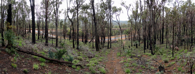
Day 8 had been part of our thinking and planning for some time, we were intent on getting to Gringer Creek and North Bannister Roadhouse in time to pick up a cooked meal; we also wanted to luxuriate over Mt Cooke with the gorgeous wild flowers – combining the two meant an early start and determined walking in the afternoon.
After descending from the wonderful panoramas of Mt Cooke, we put our heads down and walked the flat lands between Nerang and Gringer Creek as quickly as we could, and in the process passed some beautiful Wandoo woods, eventually arriving exhausted at Gringer Creek shelter for the walk down to the roadhouse and dinner.
| Length | 18.20 km | Day Length | 6:34 |
| Ascend | 600 m | Descend | 500 m |
| Walk | 4:27 | Average | 4.1 km/h |
| Breaks | 0:50 | Average | 2.8 km/h |
| Stop | 2:07 | Average | 2.8 km/h |
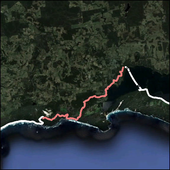
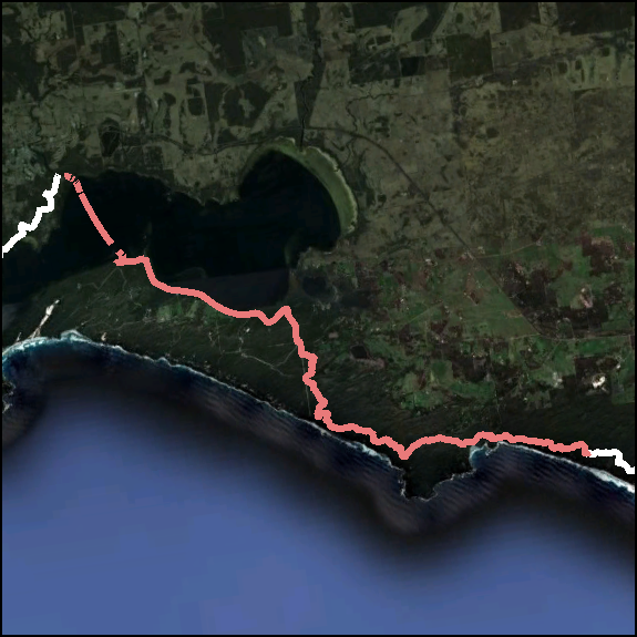
On Day 9 we pass a milestone: we cross Albany Highway: It had more significance in our minds than it did on the map, but it suddenly made us feel we were getting somewhere. The day started gloriously and cold, and after a relaxed morning we headed off through some beautiful country, across Albany Highway and toward Boonering Hill where we'll stop for Morning Tea.
The walk into lunch was through some lovely countryside and along some babbling brooks where we did some washing. The climb up into White Horse Hills was not too steep, but Sandi was having a difficult day that was compounded by a trip and fall whilst climbing over the last hill.
| Length | 15.26 km | Day Length | 4:50 |
| Ascend | 756 m | Descend | 646 m |
| Walk | 3:33 | Average | 4.3 km/h |
| Breaks | 0:00 | Average | 3.2 km/h |
| Stop | 1:17 | Average | 3.2 km/h |
Sandi has been looking forward to Day 10 because the ephemeral pools on White Horse Hills can have frogs. It's a much shorter day today, and we're both interested to finally see what the Mt Wells hut is like for ourselves. Initially though, the Track winds through some very charcoaled bush before climbing granite outcrops on its way up to White Horse Hills.
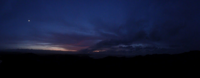
After getting a little lost on top of White Horse Hills, the Track takes us along mostly old vehicle tracks, through some inclement weather then finally up Mt Wells just in time to get in before a storm, which cleared briefly for an awesome sunset.


| Length | 15.30 km | Day Length | 3:57 |
| Ascend | 419 m | Descend | 707 m |
| Walk | 3:05 | Average | 4.9 km/h |
| Breaks | 0:00 | Average | 3.9 km/h |
| Stop | 0:52 | Average | 3.9 km/h |
After a wild night on Mt Wells we woke on Day 11 to quickly clearing skies, thankfully. Another short day today that begins with a very gentle wander down the Southern spur of Mt Wells, and then off across some Wandoo flats sometimes with Bracken ground cover. The final stretch along the river to Chadoora was through a delightful Banksia enclosed avenue; Chadoora campsite was all atwitter with a myriad of little birds.

| Length | 20.77 km | Day Length | 5:27 |
| Ascend | 587 m | Descend | 597 m |
| Walk | 4:11 | Average | 5.0 km/h |
| Breaks | 0:07 | Average | 3.9 km/h |
| Stop | 1:16 | Average | 3.8 km/h |
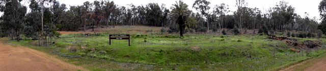
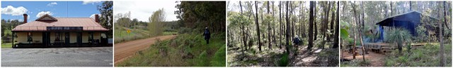
Day 12 takes us into Dwellingup; I'm sure there must be a short-cut looking at that map, but our food parcel is waiting for us at Dwellingup Caravan Park. The day starts where it left off yesterday, along Swamp Oak Brook before a stretch along Inglehope Road.
After a brief walk along a disused railway and morning tea, the Track winds toward Etmilyn Siding where we were really blessed to encounter the steam train. After Etmilyn the Track winds past the historic town site of Holyoake before finishing up at Dwellingup Trackhead, where we get to have hot showers, wash clothes, eat fresh food and go to Mass!
| Length | 13.00 km | Day Length | 3:47 |
| Ascend | 735 m | Descend | 868 m |
| Walk | 2:56 | Average | 4.4 km/h |
| Breaks | 0:00 | Average | 3.4 km/h |
| Stop | 0:51 | Average | 3.4 km/h |
Day 13 basically gets us out of Dwellingup and back on the Track proper, not a long day; but after an amazing storm over night we started out in inclement weather and arrived in Swamp Oak just before another storm came through. A difficult day because of the weather and our failing rain jackets, and then a surprise visit from a lost family that put us in a very difficult position.
| Length | 19.58 km | Day Length | 6:08 |
| Ascend | 991 m | Descend | 1021 m |
| Walk | 4:33 | Average | 4.3 km/h |
| Breaks | 0:00 | Average | 3.2 km/h |
| Stop | 1:35 | Average | 3.2 km/h |

Day 14 points us directly South again. Initially over a ridge then down to Swamp Oak Brook then up to the ridge of the Yarragil Valley where we have morning tea.
We saw our first Spider Orchid on the track up from Yarragil Brook! The Track then follows another old rail formation before crossing Allen Road then up and over the last hill to camp.

Week Three: Murray River to Yabberup

| Length | 19.22 km | Day Length | 5:52 |
| Ascend | 831 m | Descend | 733 m |
| Walk | 4:24 | Average | 4.4 km/h |
| Breaks | 0:30 | Average | 3.6 km/h |
| Stop | 1:25 | Average | 3.3 km/h |
Day 15 takes us from the misty and moist river flats up the side and past a huge array of blooming orchids and on to lunch at the Driver Road crossing.

After lunch it's a short walk over a hill and into camp at Dookanelly.
| Length | 19.71 km | Day Length | 6:34 |
| Ascend | 1213 m | Descend | 1255 m |
| Walk | 4:55 | Average | 4.0 km/h |
| Breaks | 0:00 | Average | 3.1 km/h |
| Stop | 1:39 | Average | 3.0 km/h |
Day 16 covers a number of small hills on it's way to the Historic Long Gully Bridge over the Murray River, where we had lunch (under the bridge because it was raining).
After crossing the Murray River for the final time we finally crossed the Worsely Alumina Conveyor, which had been impacting our lives for the past days, up a narrow gully then over some recently burnt bush climbing a couple of hills toward Bell Brook and an area of very wet ground before climbing a gentle rise to the campsite.

| Length | 20.56 km | Day Length | 5:44 |
| Ascend | 811 m | Descend | 707 m |
| Walk | 4:51 | Average | 4.2 km/h |
| Breaks | 0:23 | Average | 3.8 km/h |
| Stop | 0:53 | Average | 3.6 km/h |

A disappointing day, Day 17: after rising to a beautiful misty morning and a glorious start to the day along Seventy-Seven Road, we missed a turn and ended up walking along Seventy-Seven Road until the Track rejoined it.
The Track takes Wilshusen Road, which is almost dead straight, for a significant part of the day (it did get a little tiresome, funnily enough) before crossing the Harris River Flats, which were absolutely spectacular and more than made up for the difficult parts of the day!

| Length | 14.63 km | Day Length | 4:18 |
| Ascend | 551 m | Descend | 515 m |
| Walk | 3:12 | Average | 4.5 km/h |
| Breaks | 0:00 | Average | 3.4 km/h |
| Stop | 1:06 | Average | 3.4 km/h |
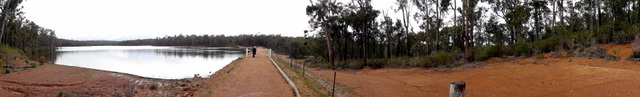
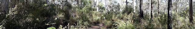
After a glorious start to Day 18 the Track heads off on today's short walk, initially through open Jarrah forest, that seemed to get taller and denser as we walked through the day. We found both examples of the wooden rails and ended up at Harris Dam campsite, which we were delighted with, for lunch. Harris Dam had a very strong sense of being in the midst of a Jarrah forest.

| Length | 24.64 km | Day Length | 6:47 |
| Ascend | 979 m | Descend | 1051 m |
| Walk | 5:09 | Average | 4.8 km/h |
| Breaks | 1:12 | Average | 4.2 km/h |
| Stop | 1:38 | Average | 3.6 km/h |

We didn't plan Day 19 to be like this, but as we needed to get into Collie as early as possible, we decided to try our hand at a bit of night walking and leave camp before dawn and walk down to the Dam and have breakfast at the lookout. The walk down was beautiful, but the lookout turned out to be a non-event because of the fog.
After breakfast we really put our heads down, walking over some pretty country, but getting closer and closer to town, which we entered (after bush-bashing our way into the Caravan Park where we were to stay) and had a cafe lunch, shopping, showers then Mass.
Day 20 is our Rest Day that we've earned through double-hutting into Dwellingup and Collie, and are wonderfully rewarded with a beautiful Vigil Mass at St Brigid's and a great relaxing day, wandering around Collie. Most of the people we told about our rest day in Collie said, "Collie?!?". Absolutely aghast with our choice: we of course didn't know anything about Collie – but the day turned out beautifully.

| Length | 20.31 km | Day Length | 5:56 |
| Ascend | 926 m | Descend | 875 m |
| Walk | 4:31 | Average | 4.5 km/h |
| Breaks | 0:20 | Average | 3.6 km/h |
| Stop | 1:25 | Average | 3.4 km/h |
Heading off on Day 21 with newly purchased wet weather gear (and weather to suit), we walked pretty well through the morning and take a break at Mungalup Dam for a cool, and quick, lunch.

After Mungalup Dam it's generally easy walking through the Jarrah forests and old roads to Yabberup, though the Guidebook does warn of confusing tracks.
Week Four: Yabberup to Tom Road
The fear of this ending has waned – it is timeless – and we're in the midst of beautiful Jarrah forests.
| Length | 21.2 km | Day Length | 6:35 |
| Ascend | 1102 m | Descend | 1166 m |
| Walk | 5:09 | Average | 4.1 km/h |
| Breaks | 1:15 | Average | 3.9 km/h |
| Stop | 1:26 | Average | 3.2 km/h |
Day 22 takes us from the serene forests of Yabberup down to Glen Mervyn Dam, where we're planning to have morning tea.


The major highlight for today is lunch at Mumby Pub, after which it's a bit of a stiff climb up to tonight's campsite over a diversion past private properties that wasn't very pleasant.

| Length | 23.48 km | Day Length | 7:07 |
| Ascend | 1105 m | Descend | 1035 m |
| Walk | 5:25 | Average | 4.3 km/h |
| Breaks | 0:00 | Average | 3.3 km/h |
| Stop | 1:42 | Average | 3.3 km/h |
Day 23 takes us along a pleasant track using old vehicle tracks and rail formations, and some virgin Jarrah that we're looking forward to experiencing.
Grimwade campsite is located over a creek on a North slope, which allows long days and beautiful sunsets and sunrises.


| Length | 21.01 km | Day Length | 6:02 |
| Ascend | 689 m | Descend | 856 m |
| Walk | 4:33 | Average | 4.6 km/h |
| Breaks | 0:00 | Average | 3.5 km/h |
| Stop | 1:29 | Average | 3.5 km/h |
Day 24 has a number of great surprises in store, the initial sections of the track along old vehicle tracks before weaving through rural properties.
The afternoon was to be a highlight, walking through the Balingup Brook Valley over the footbridge. Unfortunately the wild storms of a couple of days ago took down some trees and the DEC closed that section of the track. Even though I stood in front of the diversion sign and rang the DEC the track was closed: we called this The Great Disappointment.
But Balingup more than made up for it with the best showers and the best meal of the whole walk.

| Length | 18.15 km | Day Length | 7:07 |
| Ascend | 856 m | Descend | 722 m |
| Walk | 4:29 | Average | 4.0 km/h |
| Breaks | 0:00 | Average | 3.0 km/h |
| Stop | 1:35 | Average | 3.0 km/h |
Some days the Track just gives us a wonderful walk in the bush, and other days are full of expectation and surprises. Day 25 is one of those with lots to look forward to: initially it makes its way through Golden Valley Tree Park (which apparently is unique on the track), then the original cobblestones of Old Padbury Road and for morning tea we have what the Alpaca lady said was the best view of the Track.
After morning tea the track shares the Greenbushes Loop for a while, with an option for a detour into Greenbushes, before heading off toward old South Hampton where we stop for lunch before heading up the stiff climb to the Blackwood campsite and its wonderful views over the Blackwood River Valley.
| Length | 15.85 km | Day Length | 4:22 |
| Ascend | 751 m | Descend | 741 m |
| Walk | 3:38 | Average | 4.4 km/h |
| Breaks | 0:00 | Average | 3.6 km/h |
| Stop | 0:44 | Average | 3.6 km/h |

Many walkers write in the log book that Blackwood was their favourite campsite: and it certainly has a great location perched on the end of a ridge above the Blackwood River Valley; and the sunrise we were given today certainly matched the location!
Day 26 starts by descending off the ridge, down Cardiac Hill. Then wanders along the Blackwood river past the old Southhampton Homestead to the Southhampton Bridge over the river. We have a 'known' diversion at that point along logging roads until it rejoins the Track at Camp Creek Road for the walk into Gregory Brook.

| Length | 21.49 km | Day Length | 6:17 |
| Ascend | 812 m | Descend | 847 m |
| Walk | 4:41 | Average | 4.6 km/h |
| Breaks | 0:35 | Average | 3.7 km/h |
| Stop | 1:36 | Average | 3.4 km/h |
Day 27 starts by climbing out of Gregory Brook, then follows old logging tracks to the Brockman Highway, before descending to Willow Springs Picnic area on old roads and rail formations.
The Track crosses Donnelly River a few times using current roads before the lengthy walk along Snake Road into Donnelly River Village, where hot food and showers are available.
| Length | 16.99 km | Day Length | 4:18 |
| Ascend | 812 m | Descend | 843 m |
| Walk | 3:40 | Average | 4.6 km/h |
| Breaks | 0:00 | Average | 4.0 km/h |
| Stop | 0:38 | Average | 4.0 km/h |

After rejuvenating ourselves with plenty of food and hot water, we start out again on Day 28, initially on the local roads of Donnelly River Village, then old logging roads (to help minimise the spread of dieback).
The walk into the Tom Road campsite follows the Donnelly River: although the guidebook promised 'wonderful views' we found that they'd mostly been over grown by the bush; the campsite was superb as promised. The Tom Road campsite is the only campsite retained from the original track alignment, and overlooks a really beautiful permanent pool in the Donnelly River.

Week Five: Tom Road to Northcliffe

| Length | 24.69 km | Day Length | 6:53 |
| Ascend | 1217 m | Descend | 1240 m |
| Walk | 5:20 | Average | 4.6 km/h |
| Breaks | 0:29 | Average | 3.6 km/h |
| Stop | 1:33 | Average | 3.6 km/h |
Day 29 is a delightful wander along the Donnelly River into the Boarding House campsite.

Today's lunch stop was a huge surprise, as the Guidebook didn't hint at it at all, and was an awesome, and thunderous, spot beside the river.

Boarding House campsite is reached by crossing the Boarding House Bridge which was build by the Army reserve: it's these custom, quirky parts of the Track that makes the Bibbulmun so special.

| Length | 20.23 km | Day Length | 5:48 |
| Ascend | 1084 m | Descend | 1143 m |
| Walk | 4:52 | Average | 4.1 km/h |
| Breaks | 0:00 | Average | 3.5 km/h |
| Stop | 0:56 | Average | 3.5 km/h |
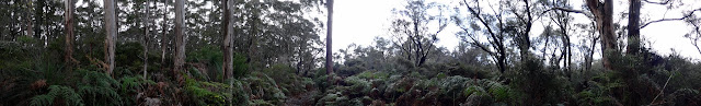
Day 30 encompasses what the Guidebook describes as 'one of the more challenging sections' of the Track. Initially the Track winds up on the Wirraway Formation through stunning Karri forests.

The hills get steeper descending into and ascending out of a couple of river crossings, after which the Track follows the rim of the Donnelly Valley with quite different soils and vegetation.

After another wander beside the Donnelly River, the Track eventually winds around to the really lovely Beavis campsite that has a swim-able wee dam.
| Length | 21.18 km | Day Length | 6:55 |
| Ascend | 1142 m | Descend | 1122 m |
| Walk | 5:03 | Average | 4.2 km/h |
| Breaks | 0:00 | Average | 3.1 km/h |
| Stop | 1:52 | Average | 3.1 km/h |
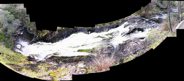
Day 31 will finally take us away from the Donnelly River for the last time, which we are not unhappy about: it's been an extended period of moss, rotting stumps and fungi. From the majestic Karri forests around Beavis the Track winds through some smaller communities of Jarrah/Marri forests, and a lovely lunch stop at Carey Brook waterfall.

Karri Valley Resort and its lake and Beedelup Falls are quite stunning, before the short walk into the Beedelup campsite at the end of the day.

Spent quite a bit of time over the last couple of days thinking about the effect of the DEC four-wheeler bikes on the track that I had a rant about here.
| Length | 24.73 km | Day Length | 6:42 |
| Ascend | 852 m | Descend | 897 m |
| Walk | 5:18 | Average | 4.7 km/h |
| Breaks | 0:26 | Average | 4.0 km/h |
| Stop | 1:24 | Average | 3.7 km/h |
After an early start Day 32 takes us from the forests surrounding Beedelup Falls down though the Big Brook Arboretum to the Big Brook Dam.

The walk into Pemberton follows Lefroy Brook, which has some beautiful vegetation and views along the way. Pemberton is a good-sized town where we should get a good cafe afternoon tea and hot showers at the caravan park, where our food parcel is waiting for us.
| Length | 21.64 km | Day Length | 6:38 |
| Ascend | 1001 m | Descend | 997 m |
| Walk | 5:15 | Average | 4.1 km/h |
| Breaks | 0:37 | Average | 3.6 km/h |
| Stop | 1:23 | Average | 3.3 km/h |

Day 33 would have been gorgeous if it was sunny, but was cold and wet for the whole day, which we enjoyed for about 90% of the day until we got wet through. The day starts by walking out from Pemberton to Gloucester Tree, where there is an optional diversion down to the Lefroy Cascades.


The afternoon's walk is spent beside the Warren River, deep in the Warren River Valley walking over a multitude of little ascents and descents, until the final short climb up to the campsite on the side of the valley.

| Length | 21.39 km | Day Length | 5:50 |
| Ascend | 1096 m | Descend | 1009 m |
| Walk | 4:50 | Average | 4.4 km/h |
| Breaks | 0:00 | Average | 3.6 km/h |
| Stop | 1:00 | Average | 3.6 km/h |

Day 34 starts on the wee hill that the Warren campsite is located on, which we climbed the previous day in the rain; but descends back down to the river almost immediately, which it follows for most of the morning.


The short afternoon walk turns South away from the River and passes some pretty farmland before arriving at Schafer, which is sited above a very picturesque dam, which provided some gorgeous sunset and sunrise photographs.


| Length | 14.70 km | Day Length | 3:17 |
| Ascend | 423 m | Descend | 470 m |
| Walk | 2:54 | Average | 5.1 km/h |
| Breaks | 0:00 | Average | 4.6 km/h |
| Stop | 0:23 | Average | 4.5 km/h |

Day 35 is one of our shortest days, we could almost have walked it yesterday but then would have missed the wonderful sunset and sunrise – a great lesson to stay in the moment!

The Track initially passes through some floriferous bush before traversing a open, swampy area.
Closer to town the Track winds through private properties and along country roads before we drop our packs at the RoundTu-It Holiday Park, and after putting some washing on, head into town to finish the section and sign in at the Information Centre.


Week Six: Northcliffe to Rest Point
| Length | 17.51 km | Day Length | 4:41 |
| Ascend | 735 m | Descend | 776 m |
| Walk | 3:45 | Average | 4.7 km/h |
| Breaks | 0:00 | Average | 3.7 km/h |
| Stop | 0:56 | Average | 3.7 km/h |

Day 36 started with a wee walk into town to the start of today's section, after which we criss-cross Wheatley Road a number of times before feeling like we were out of town and on the walk proper.


Later in the day the Bibbulmun makes use of the Laws Track on its way to Gardner Shelter.


| Length | 16.90 km | Day Length | 5:12 |
| Ascend | 649 m | Descend | 654 m |
| Walk | 3:51 | Average | 4.4 km/h |
| Breaks | 0:00 | Average | 3.3 km/h |
| Stop | 1:21 | Average | 3.3 km/h |

Day 37 continues along Laws Track through some amazingly beautiful swampy areas interspersed with mature stands of Karri and Jarrah before crossing the Gardner River over the Chesapeake Road Bridge.


The Track into Maringup Lake traverses similar country and eventually uses Lake Road, which can often be inundated, before terminating (somewhat abruptly) at the beautiful Lake Maringup.


| Length | 26.11 km | Day Length | 7:31 |
| Ascend | 1183 m | Descend | 1219 m |
| Walk | 5:47 | Average | 4.5 km/h |
| Breaks | 0:00 | Average | 3.5 km/h |
| Stop | 1:44 | Average | 3.5 km/h |
Day 38 started with the promised gorgeous sunrise over Lake Maringup and ended with an amazing display by the Shannon River. And in between the Track took us through thick, wet Karri forests and intermittently open heath and swamps, with a fair bit of wading through inundated areas.

The track into Dog Pool wends over stunning open swampy areas and vast grass lands, before terminating at the shelter on the banks of the Shannon River.

| Length | 20.32 km | Day Length | 5:53 |
| Ascend | 818 m | Descend | 723 m |
| Walk | 4:20 | Average | 4.7 km/h |
| Breaks | 0:00 | Average | 3.4 km/h |
| Stop | 1:33 | Average | 3.5 km/h |

Day 39 starts on the banks of the Shannon River then follows first Dog Road, then the sandy Marron Road, up to Pingerup Road and the Pingerup Plains.


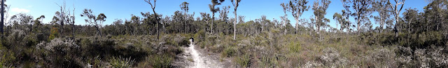
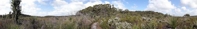
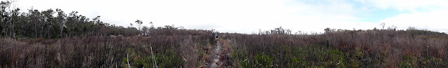
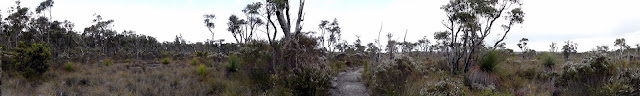
The track across the Pingerup Plains cuts through a diverse mix of heathland and reedy swamps, intermittently passing through mature forests perched on low hummocks formed by underlying granite.

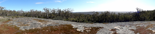
The Mt Chance campsite is located at the foot of the granite dome, Mt Chance, from which it is named. The dome is well worth the climb up for the magnificent 360° views.

| Length | 23:48 km | Day Length | 7:30 |
| Ascend | 824 m | Descend | 885 m |
| Walk | 5:29 | Average | 4.3 km/h |
| Breaks | 1:13 | Average | 3.7 km/h |
| Stop | 2:01 | Average | 3.1 km/h |

When setting up the itinerary for the walk we'd identified Mt Pingerup as a good morning tea location for Day 40, leaving our packs at the junction and walking up the optional 1.5km round trip for the expansive views. In fact today is full of views, starting with dawn on Mt Chance and finishing with the hill behind Woolbales and Mt Pingerup in the middle!


Mt Pingerup, although expansive, didn't really suit a panorama shot. After morning tea, the track heads back out onto the Pingerup Plains, over some better class soils and taller forests, through some significant inundation after Inlet River before reaching the glorious views at Woolbales.


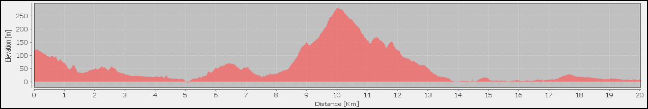
| Length | 19.23 km | Day Length | 7:51 |
| Ascend | 1449 m | Descend | 1431 m |
| Walk | 5:20 | Average | 3.6 km/h |
| Breaks | 0:00 | Average | 2.5 km/h |
| Stop | 2:31 | Average | 2.4 km/h |

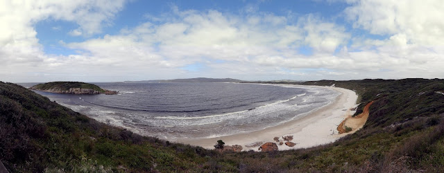
Day 41 finally gets us to the Great Southern Ocean! The sunrise from the hill behind Woolbales is worth a visit. The Track sets out on low ground before crossing various granite outcrops with nice views and incredible formations (including Watermelon Rock).


As the Southern coast gets closer the vegetation and soils change distinctly, until the Track deviates up to a gorgeous lookout on the edge of the continent (which is a great morning tea stop by the way).


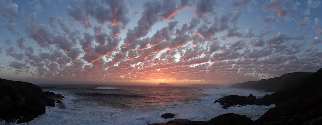
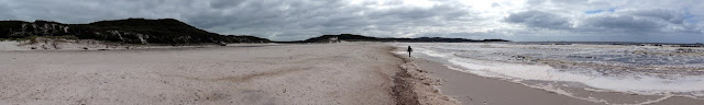
The day ends at Long Point after some beach walking and climbing of many sand dunes; but a track past the shelter leads down to the coast where awesome sunsets can often be seen and are just the medicine for the weary soul.

| Length | 22.01 km | Day Length | 7:18 |
| Ascend | 1110 m | Descend | 1166 m |
| Walk | 4:59 | Average | 4.4 km/h |
| Breaks | 0:58 | Average | 3.4 km/h |
| Stop | 2:19 | Average | 3.0 km/h |
Day 42 is another 'Double-Hutter' combining the Track's Sections 45 & 46. Starting off at the bottom of Long Point the Track winds over coastal dunes, up into the Hush Hush Hills and finishing Section 45 in the midst of tall Karri and immense Tingle Trees at Mt Clare.

The afternoon tracks Tinglewood Drive then the South-Western Highway past some awesome views over the inlet at John Rate Lookout and then to Rest Point Road, where we leave the Track to find our accommodation for the night, and another food drop to refill our packs, at the Rest Point Caravan Park.


Week Seven: Rest Point to William Bay

| Length | 9.08 km | Day Length | 2:08 |
| Ascend | 265 m | Descend | 249 m |
| Walk | 1:49 | Average | 5.0 km/h |
| Breaks | 3:54 | Average | 4.7 km/h |
| Stop | 0:19 | Average | 4.3 km/h |
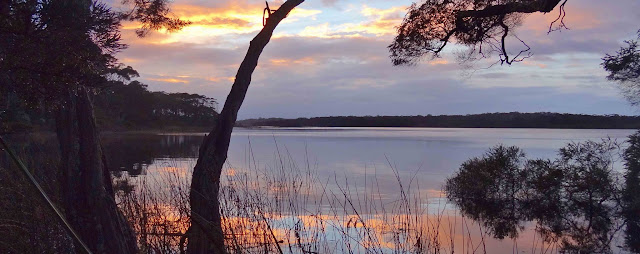
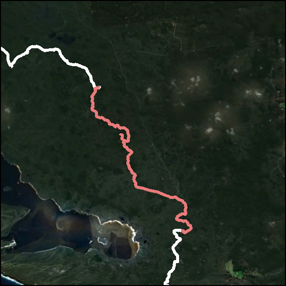
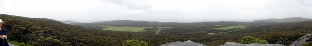
Day 43 is essentially a rest day where we only have a 10km wander from one Caravan Park on one side of Walpole to another on the other side of Walpole: not a standard day on the normal Bibbulmun Itinerary. None-the-less, the day starts with a beautiful dawn on Walpole Inlet, before crossing an extensive boardwalk and Walpole River and then entering Walpole Town for breakfast.


After attending to our town duties (meals, shopping, postcards) we embark on the afternoon's walk out to Coalmine Beach. This part of the walk is almost entirely on the shore of the inlets.


| Length | 15.04 km | Day Length | 5:15 |
| Ascend | 634 m | Descend | 619 m |
| Walk | 3:32 | Average | 4.2 km/h |
| Breaks | 0:00 | Average | 2.8 km/h |
| Stop | 1:43 | Average | 2.9 km/h |
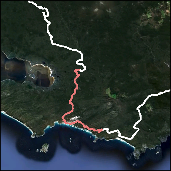
Our Day 44 completes Section 47 that we started yesterday, and so another easy day. The day starts on the bank of Nornalup Inlet and Coalmine Beach before leaving the town behind by crossing the Highway and climbing into the "best Karri / Tingle / Sheoak forest in the South-West".


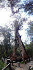 The Giant Tingle Tree is a popular tourist stop, and it's easy to see why: these beasts are amazing - getting lost inside a hollow tree is bizarre.
The majority of the walk from here into Frankland is along Tingle Drive, which does have glimpses into the valley beside the road.
The Frankland campsite is beautiful, positioned on the banks of the river of the same name. It's easy to understand the Foundation's stressing that these campsites are only for overnight visits: this one almost locks you in once you get there.


| Length | 15.26 km | Day Length | 6:09 |
| Ascend | 832 m | Descend | 724 m |
| Walk | 3:40 | Average | 4.1 km/h |
| Breaks | 1:58 | Average | 3.6 km/h |
| Stop | 2:29 | Average | 2.5 km/h |

Day 45 is a short walk from Frankland River to Giants, via the Tree Top Walk. The day starts in the beautiful Frankland River Valley and crosses the river over Sappers Bridge and up Brainy Cut Off Road into some wonderful mature Jarrah / Marri forest.


The Tree Top Walk is an amazing attraction and well worth an extended stop. The Giants campsite is a short 30 minute walk further on.


| Length | 18.15 km | Day Length | 6:26 |
| Ascend | 1069 m | Descend | 1085 m |
| Walk | 4:27 | Average | 4.1 km/h |
| Breaks | 0:48 | Average | 3.2 km/h |
| Stop | 1:59 | Average | 2.8 km/h |
Day 46 starts under the tall timber that surrounds the Giants campsite and climbs over a small hill and down to cross the South Coast Highway before climbing up Nuts Road to some wonderful coastal views.


The Track passes through some interesting country, home of the Red Flowering Gum (which wasn't at this time of year) before heading to the coast, and Conspicuous Beach, along the ridges of sand dunes.


After a short walk along Conspicuous Beach the Track climbs up the limestone hills behind Conspicuous Cliffs, which offers wonderful views to the West Coast and a bushfire the smoke of which coloured the sunset nicely.


| Length | 12.45 km | Day Length | 3:45 |
| Ascend | 634 m | Descend | 729 m |
| Walk | 2:56 | Average | 4.2 km/h |
| Breaks | 0:25 | Average | 3.8 km/h |
| Stop | 0:49 | Average | 3.3 km/h |
Day 47 started in the very early pre-dawn with breakfast curry and a splendid sunrise, before heading off on today's short section, which is a circuitous route into Peaceful Bay.

The Track initially drops down to the sand dunes and tracks East parallel to the coast, before traversing The Gap Beach then climbing up and over Castle Rock on Point Irwin.

From the magnificent views, and wonderful Morning Tea stop, of Castle Rock it is a very short walk North along the coast via Soft Beach and into Peaceful Bay and the overnight accommodation of Peaceful Bay Caravan Park: The end of Section 50.

| Length | 23.98 km | Day Length | 7:35 |
| Ascend | 2152 m | Descend | 2140 m |
| Walk | 6:09 | Average | 3.9 km/h |
| Breaks | 0:38 | Average | 3.4 km/h |
| Stop | 1:26 | Average | 3.2 km/h |

Day 48 comprises a "long and challenging day", which funnily enough we've been looking forward to because of the canoe paddle.
The day of course starts in Peaceful Bay, and heads North-West out of town before curling around to walk parallel to the beach until it emerges, somewhat suddenly, at Irwin Inlet.

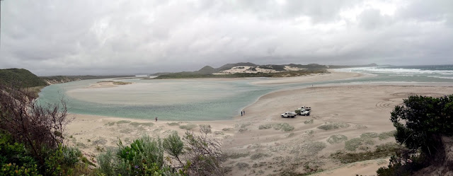
The Track heads inland up the inlet to a more sheltered position for the canoe crossing. It's important to ensure that there are plenty of canoes on both sides of the crossing, and we end up making the crossing three times (getting our money's worth)!

After the canoe crossing the Track winds through The Showgrounds toward Big Quarram Beach, which we walked in quite heavy rain (keeping the camera in its waterproof bag).

The track leads on past Little Quarram Beach and on through the sand hills to the Boat Harbour campsite nestled in the sand hills.

| Length | 22.82 km | Day Length | 7:25 |
| Ascend | 1581 m | Descend | 1503 m |
| Walk | 5:27 | Average | 4.2 km/h |
| Breaks | 0:08 | Average | 3.1 km/h |
| Stop | 1:58 | Average | 3.1 km/h |

Day 49 starts with a short walk down to the Boat Harbour beaches, then traverses the sand hills up to Hillier Lookout.


Hillier Trig is well worth the short climb for the lovely views. After Hillier Trig the Track winds down to Parry Beach and Inlet, through the Camping Ground and then the 8.5km walk along Mazzoletti Beach.


A diversion was in place today, which took us all the way into Green's Pool and up the stairs to William Bay Road then a 4WD track up to William Bay Campsite: not the prettiest part of the Track; but we were rewarded at the end of the day with an awesome sunset from the rocks on the hill behind the campsite.

Week Eight: William Bay to Albany
| Length | 20.55 km | Day Length | 6:13 |
| Ascend | 1198 m | Descend | 1302 m |
| Walk | 4:59 | Average | 4.1 km/h |
| Breaks | 0:00 | Average | 3.3 km/h |
| Stop | 1:14 | Average | 3.3 km/h |
Day 50 will bring us to our last track town: Denmark, where we left our last food parcel almost 2 months ago! It's a shortish day, and as has become our want, we start quite early (to ensure we find open shops at the other end). This morning starts misty as we descend to Lights Beach, before heading across some low-lying land and then climbing up Mt Hallowell.


Monkey Rock turned out to be a wonderful morning tea stop, especially after the rain had ceased, with magnificent views to the coast.
Going down the other side of Mt Hallowell some good views can be had from Alec's Rock, an open platform of the plentiful granite in the area, before reaching the outskirts of Denmark where the track winds around Wilson Inlet to the Trail Head (and our accommodation).


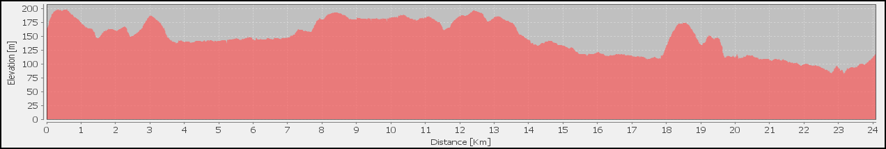
| Length | 31.97 km | Day Length | 8:52 |
| Ascend | 1651 m | Descend | 1489 m |
| Walk | 6:34 | Average | 4.9 km/h |
| Breaks | 0:00 | Average | 3.6 km/h |
| Stop | 2:18 | Average | 3.6 km/h |
Our Day 51 combines Sections 54 & 55 into one long day. The day starts early with Mad Fish Charters, who is carrying us across Wilson Inlet to the Nullaki Peninsular. After alighting to the wharf on the other side the Track passes Pelican Point and some very weed infested land on the way to Nullaki Campsite.


After Nullaki Campsite the Track continues South toward the coast, where it turns East behind Knapp Head and Lowlands Beach, and on to West Cape Howe Campsite over many ridges that offer good views in every direction.


| Length | 16.93 km | Day Length | 5:44 |
| Ascend | 926 m | Descend | 1033 m |
| Walk | 4:04 | Average | 4.2 km/h |
| Breaks | 0:00 | Average | 3.0 km/h |
| Stop | 1:40 | Average | 3.0 km/h |

After the efforts of yesterday Day 52 is a much easier day around West Cape Howe to Torbay Campsite. The hill in front of the shelter offers sweeping views East to West Cape Howe, where we're walking today,

Leaving the campsite the Track winds through beautiful sandy scrub and heath on the coastal sand ridges.


The Track joins the Bruce Tarbotton Memorial Walk for a short distance over a narrow ridge, after which the Track turns North and crosses broad granite slabs before entering Melaleuca and heath above Dingo Beach.


Torbay Campsite is nestled into the hill and vegetation, but expansive views are available from the picnic table at the top of the hill a short walk beside the shelter.


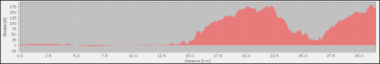
Day 53 is our penultimate day and we're determined to make sure we enjoy every minute we've got left on the walk: it actually starts with a fantastic sunrise over the Great Australian Bight. The day starts in low coastal scrub before passing through our beloved Casuarina thicket, and then down the stairs to the beach via Cosy Corner.


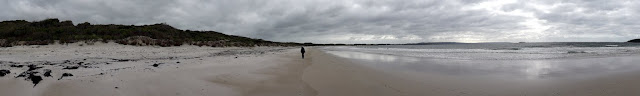
Torbay Inlet must be crossed, then 7km of beach walking before ascending the timber stairs to the headland and an awesome view over Port Hughes.
The Track East initially passes through some great landscapes with good views from the ridges before the diversion (due to expansion of the wind farm) and eventually, after some less than pleasant track, Hidden Valley Campsite.


| Length | 19.87 km | Day Length | 5:35 |
| Ascend | 763 m | Descend | 825 m |
| Walk | 4:17 | Average | 4.6 km/h |
| Breaks | 0:00 | Average | 3.5 km/h |
| Stop | 1:18 | Average | 3.6 km/h |
Day 54 is our last day of walking (unbelievably): The pull of Albany almost palpable; but before we get to the Trackhead there is a very pleasant walk through the wind farm along the coast before turning inland through Torndirrup National Park.


Torndirrup National Park initially lulls us into a relaxed walk through its peaceful landscapes, before showing us Albany across the harbour.


The walk into Albany runs around the shore of the harbour before it climbs up into residential streets, and then all too suddenly the Trackhead and the end of the walk.


Post Walk: Albany back to Real Life
We see Jesus in a new light, know Western Australian bush more intimately, understand ourselves more and I hold my beautiful wife in more complete awe for her patience, understanding, courage and perseverance. May the walk, which has taken us along the length of the Bibbulmun Track, continue before us and within us.
Because of our double-hutting and lack of delays, we've managed to keep our 'holiday' in Albany (day being the operative word). So we have a day beginning with Mass at St. Joseph's, shopping, clothes washing, sightseeing and lots of eating in between times.
What can you say about a 6-hour bus trip back to Perth?
""
Seriously though: Red Dog on the bus entertainment was an interesting counterpoint to our memories, and driving past the hills we walked over 2 months ago was a strangely emotional experience.
Perth was a chance to catch up with family and friends (that we'd neglected pre-walk in our rush)

- » Feeling out of sync and looking for the simplicity of walking
- » Continually colliding with fellow track walkers around Albany as if our paths were ordered by a different gravitational pull.
- » 6 hours on the bus with percolating memories and brewing fantasies
- » Walking the Swan into town and being swept along by the hustle and bustle of the city and finding again more poor coffee that rivals our track memories.
And after what turned out to be a very odd time in Perth, we headed back home: The Bibbulmun in the past, but lots of data, words and photos to process – but as I expressed in the diary we'd "run out of track and it's come to an end, but I hope it doesn't finish."
It's a long plane trip between Perth and Sydney. Nathanael picked us up at the airport (in our car) and we drove home, wondering all the way what we'd find.
The Bibbulmun Wrap-up puts our final thoughts on our Bibbulmun experience:
- Financial Cost of the Walk
- Our Walk in Numbers
- On-Track Projects
- Things that Didn't Work
- Things that Did Word
- Essentials for the Perfect Poncho
- Blisters Treatment
After collecting so much data on our Bibbulmun walk it's only natural to mash it together to review some of our gear:
If this site has been any benefit to you why not consider a donation to help cover costs?
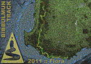
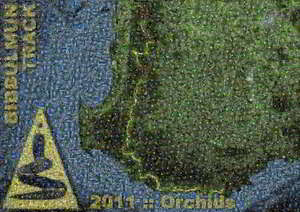
All donations, however big or small, will receive access to the Bibbulmun mosaic posters which they can print out.
Posters
Downloads
Google Earth Day Tracks
- Day One
- Day Two
- Day Three
- Day Four
- Day Five
- Day Six
- Day Seven
- Day Eight
- Day Nine
- Day Ten
- Day Eleven
- Day Twelve
- Day Thirteen
- Day Fourteen
- Day Fifteen
- Day Sixteen
- Day Seventeen
- Day Eighteen
- Day Nineteen
- Day Twenty-One
- Day Twenty-Two
- Day Twenty-Three
- Day Twenty-Four
- Day Twenty-Five
- Day Twenty-Six
- Day Twenty-Seven
- Day Twenty-Eight
- Day Twenty-Nine
- Day Thirty
- Day Thirty-One
- Day Thirty-Two
- Day Thirty-Three
- Day Thirty-Four
- Day Thirty-Five
- Day Thirty-Six
- Day Thirty-Seven
- Day Thirty-Eight
- Day Thirty-Nine
- Day Forty
- Day Forty-One
- Day Forty-Two
- Day Forty-Three
- Day Forty-Four
- Day Forty-Five
- Day Forty-Six
- Day Forty-Seven
- Day Forty-Eight
- Day Forty-Nine
- Day Fifty
- Day Fifty-One
- Day Fifty-Two
- Day Fifty-Three
- Day Fifty-Four
Google Earth Section Tracks
- Section 1
- Section 2
- Section 3
- Section 4
- Section 5
- Section 6
- Section 7
- Section 8
- Section 9
- Section 10
- Section 11
- Section 12
- Section 13
- Section 14
- Section 15
- Section 16
- Section 17
- Section 18
- Section 19
- Section 20
- Section 21
- Section 22
- Section 23
- Section 24
- Section 25
- Section 26
- Section 27
- Section 28
- Section 29
- Section 30
- Section 31
- Section 32
- Section 33
- Section 34
- Section 35
- Section 36
- Section 37
- Section 38
- Section 39
- Section 40
- Section 41
- Section 42
- Section 43
- Section 44
- Section 45
- Section 46
- Section 47
- Section 48
- Section 49
- Section 50
- Section 51
- Section 52
- Section 53
- Section 54
- Section 55
- Section 56
- Section 57
- Section 58
Photo Albums
Flora of the Track
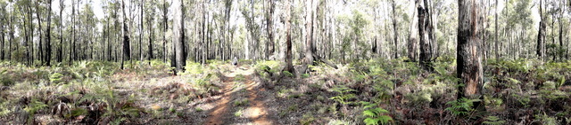
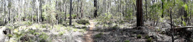
Panoramas of the Track
Photographs of the Track
Fauna of the Track
Bibbulmun 2011 Photographs
Other Links
Mitupela.net
 Personal Website by Perry Mowbray is licensed under a Creative Commons Attribution-NonCommercial-NoDerivs 3.0 Unported License.
